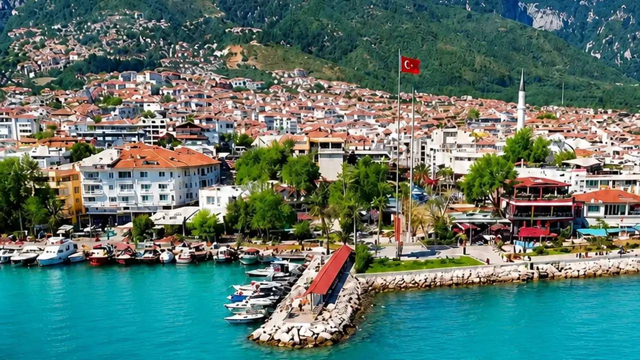
Where Is Adalar Denizi (Aegean Sea)?
Adalar Denizi (“Sea of Islands”) — known today mostly as the Aegean Sea — is the arm of the Mediterranean that lies between Turkey and Greece. It stretches from the Dardanelles and the coasts of Thrace in the north to Crete in the south; its entire eastern shore belongs to Turkey (Çanakkale, Balıkesir, İzmir, Aydın, Muğla) and its western shore to Greece. It holds close to 3,000 islands and islets of all sizes — which is exactly where its historical Turkish name comes from.
What Is Adalar Denizi (Aegean Sea) Like?
In Ottoman geography and on the maps of the early Republic, this sea was called “Adalar Denizi” (in Ottoman Turkish Cezayir-i Bahr-i Sefid, “the islands of the Mediterranean”) — a descriptive name reflecting the density of its islands. The name “Aegean” comes from King Aegeus of Greek mythology (the king who threw himself into the sea believing his son Theseus was dead) and, with international usage from the mid-20th century onwards, also became common in Turkish. Although “Ege Denizi” (Aegean Sea) dominates in official and everyday language today, “Adalar Denizi” lives on in Turkish maritime tradition and in some institutional texts. Both names describe the same sea; one carries mythology, the other geography.
Places to Visit in Adalar Denizi (Aegean Sea)
Turkey’s largest island, known for organic farming, windsurfing and its Greek villages. Ferry from Kabatepe ~1 h 15 min.
Turkey’s wine island, with its vineyards, castle and stone houses. Ferry from Geyikli ~35 min.
Linked to the mainland by a bridge; with its stone streets and fish restaurants, the pearl of the bay.
More than 20 islands and islets; daily boat tours and diving spots.
The Greek Islands Closest to Turkey: Distances and Departure Ports
Off Ayvalık; ~10 km from the coast at the closest point. Ferry: ~1.5 hours from Ayvalık Port — Edremit Bay’s gateway to the islands.
~8 km from Çeşme. Ferry: 30–45 min from Çeşme Port; one of the busiest day-trip routes.
At ~1.7 km from the Kuşadası–Dilek Peninsula, the Greek island closest to Turkey. Ferry: ~1 hour from Kuşadası.
~5 km from Bodrum. Ferry: ~20 min from Bodrum; day trips with a passport.
~40 km from Marmaris. Ferry: ~1 hour from Marmaris; the centre of the Dodecanese.
~2 km from Kaş; so close it looks within swimming distance of the Turkish coast. Ferry: ~20 min from Kaş.
On the Kavala–Alexandroupoli line; Gökçeada’s northern neighbours.
What Kind of Sea Is Adalar Denizi (Aegean Sea)?
Adalar Denizi is known for its deep blue colour, its clarity and the poyraz that blows steadily in summer (the etesian/meltem winds). Its northern part — including Edremit Bay — is a few degrees cooler and less salty than the south, giving it a refreshing character in the summer heat. The coves on the Turkish coast (the bay, between the Ayvalık islands) are sheltered from the wind and well suited to family boating.
Frequently Asked Questions
Are Adalar Denizi and the Aegean Sea the same sea?
Yes. “Adalar Denizi” is the historical Turkish name and “Ege Denizi” (Aegean Sea) the name of mythological origin that is common today; both refer to the same sea between Turkey and Greece.
Which Greek island is closest to Turkey?
Samos, about 1.7 km from the Dilek Peninsula, is the closest; Kastellorizo (Meis) is also only ~2 km from Kaş.
How do you get from Edremit Bay to the Greek islands?
The most practical route is via Ayvalık Port: regular ferries to Lesbos take about 1.5 hours. Sailings become more frequent in the summer season; a passport (and, depending on nationality, a visa or visa-on-arrival) is required.
Why is the Aegean so clear?
The deep basins of the Sea of Islands, its strong currents and short rivers carrying little sediment keep the water clear; the northerly poyraz wind also constantly renews the surface water.
Adalar Denizi (Aegean Sea) at a Glance
The historical Turkish name of the Aegean: the sea of nearly 3,000 islands between Türkiye and Greece — name history, nearest islands, distances and ferry ports. The area lies on the coastal strip of Edremit Bay and has attracted strong interest from property investors in recent years.
Key Features of the Area
- Nearly 3,000 islands
- Lesvos 1.5h from Ayvalık
- Samos 1.7 km offshore
- Gökçeada & Bozcaada
- Cool summer sea
Property Options in Adalar Denizi (Aegean Sea)
Adalar Denizi (Aegean Sea) lies on the coastal strip of Edremit Bay and stands out for features such as Nearly 3,000 islands and Lesvos 1.5h from Ayvalık. Our portfolio in the area is updated continuously; you can also find current opportunities through the nearby area guides below.
Is Investing in Adalar Denizi (Aegean Sea) a Good Idea?
Short answer: Yes. Adalar Denizi (Aegean Sea) stands out as one of the fastest-appreciating areas of Edremit Bay. Thanks to its proximity to the beach, sea views and summer tourism income, it is chosen both for permanent living and for investment.
Investment Advantages
- Regional growth potential — over 29% value increase in the last 5 years
- Strong rental income from summer tourism (for coastal locations)
- Nearly 3,000 islands — the area's signature feature
- Close to Istanbul (5 hours) and İzmir (3 hours)
- Straightforward title deed (tapu) procedures for foreign investors
- Investments of $400,000+ can be used for Turkish citizenship
Adalar Denizi (Aegean Sea) and Nearby Areas
The areas neighbouring Adalar Denizi (Aegean Sea) also offer valuable investment opportunities. Compare areas by browsing the guides below: